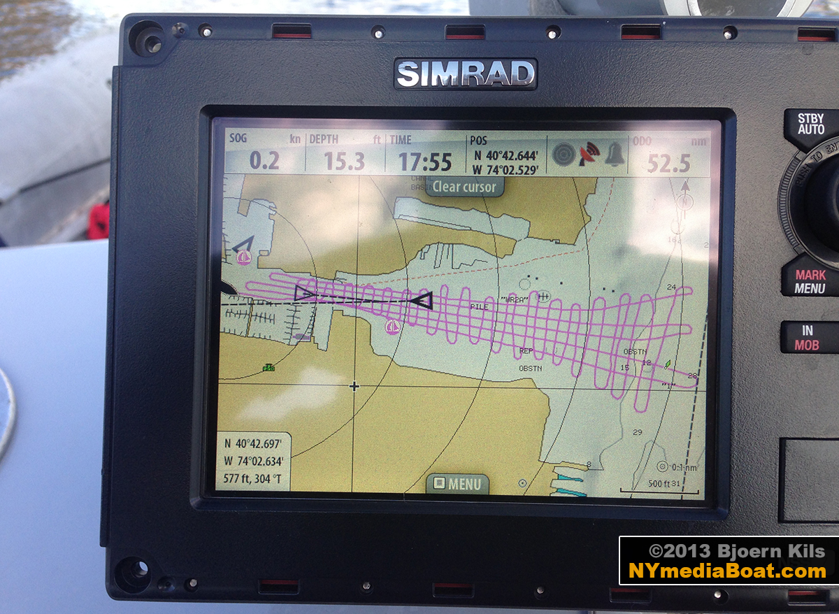
Here’s the latest intel on Morris Canal: A few months ago, Matt and I decided to create a custom map of the entrance to Liberty Landing Marina. Using the ‘Record Sonar’ Function on the Simrad Chart Plotter, we spent about 45 minutes running a north-south grid at clutch speed, followed by a few east-west passes for additional data points. The water level was three feet down from high tide.
After uploading the collected data, a contour map of the surveyed area was generated. Using Photoshop, I overlaid some additional satellite imagery plus elements from a NOAA raster chart to build the final image:
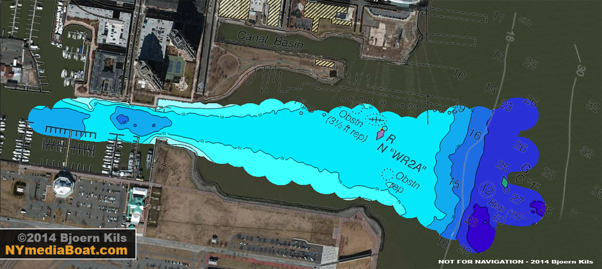
Looking at the composite, the edge of the channel is now clearly indicated by a 10-foot depth contour line, and a 20-foot deep hole is visible just north of C-dock — most likely created by the prop wash from the Little Lady when she docks at Warren Street.
Check back for part two of this project, as we plan to survey D-dock to the West End, merging all data for one complete chart.